Hello, I’m Sylvie Falardeau, a geogapher, cartographer, and spatial thinker! On this page you can find two of my favorite remote sensing projects from my time at Middlebury. Click on the image bookmarks to follow links to my full maps and posters!
Remote Sensing Research
Temporal Methods in Woodlot Detection
As research assistants working with Professor Kimambo, Brooke Laird and I developed this poster representing our efforts to compare different temporal methods for mapping woodlots from Landsat and Sentinel imagery. We presented at the Spring Symposium in 2021, in a forum with many poster presenters from other departments and fields of study. Essentially, we found that classifying a stack of monthly Tasseled Cap Wetness images out-performed two other algorithms used in temporal classification, LandTrendr and CCDC.
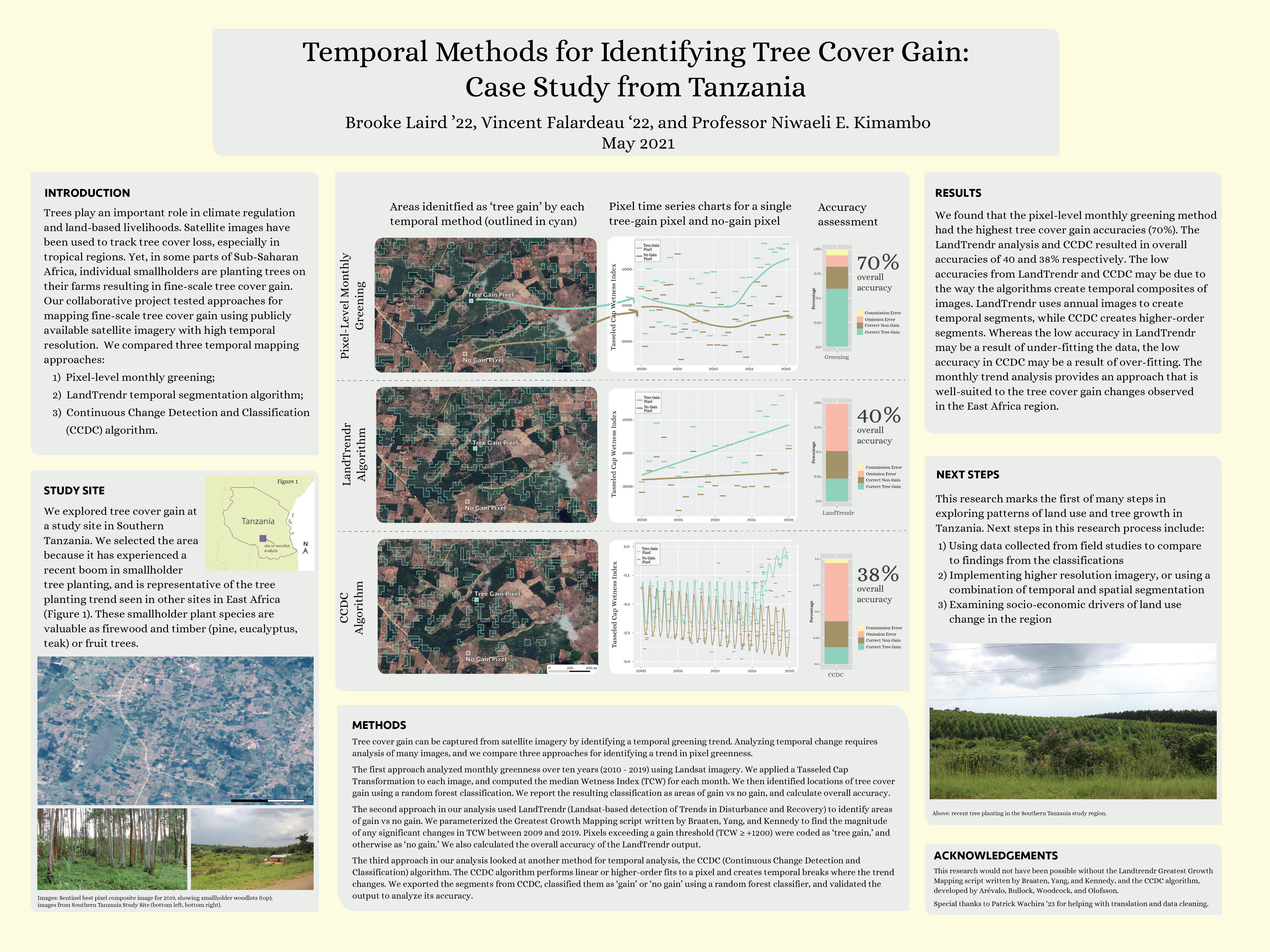
Image Segmentation and Woodlot Mapping
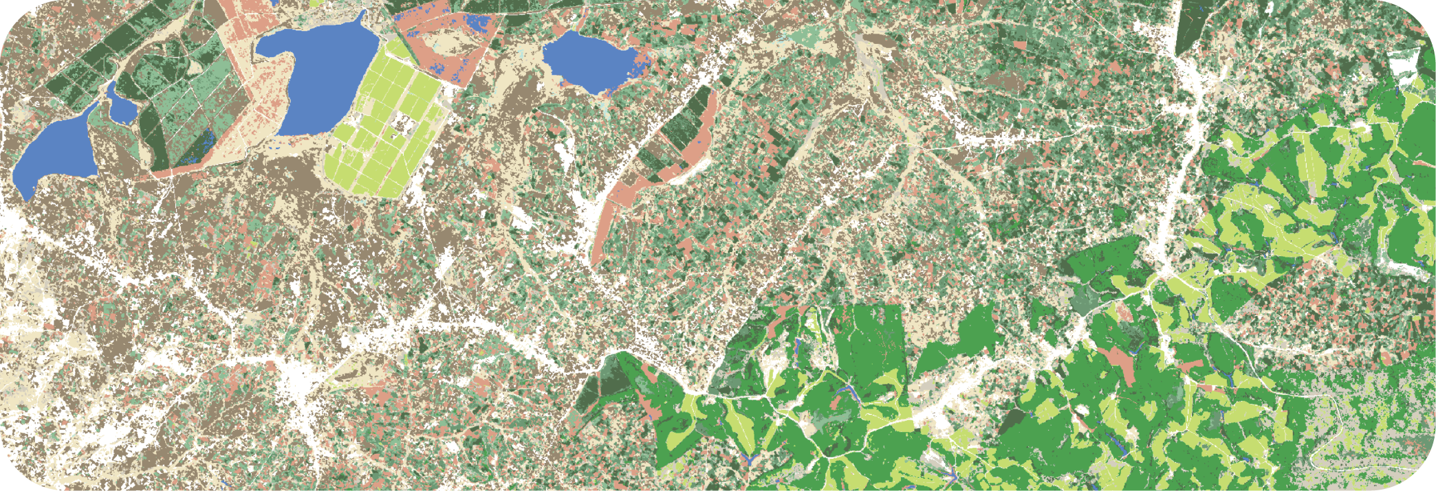
Leveraging high-resolution Planet Labs satellite imagery for accurate woodlot mapping in Tanzania was one of my favorite projects at Middlebury College. I produced this map independently at the end of summer 2021, which I spent in Middlebury doing research with Professor Niwaeli Kimambo and Leo Sovell-Fernandez. In Spring 2022 I continued my analysis of Planet Labs imagery, extending the landcover classification over a much larger area, for the purposes of comparison among 67 study villages.